A Cosmography of Faith, Knowledge & Order: Inside the Vatican’s Gallery of Maps
The Gallery of the Geographical Maps transformed cartography, astronomy, art, and institutional vision into one of the Renaissance’s most ambitious interiors.
Within the Vatican Museums, the Gallery of the Geographical Maps is more than a corridor between collections. It is a monumental statement about how a civilization understands the world and its responsibility within it.
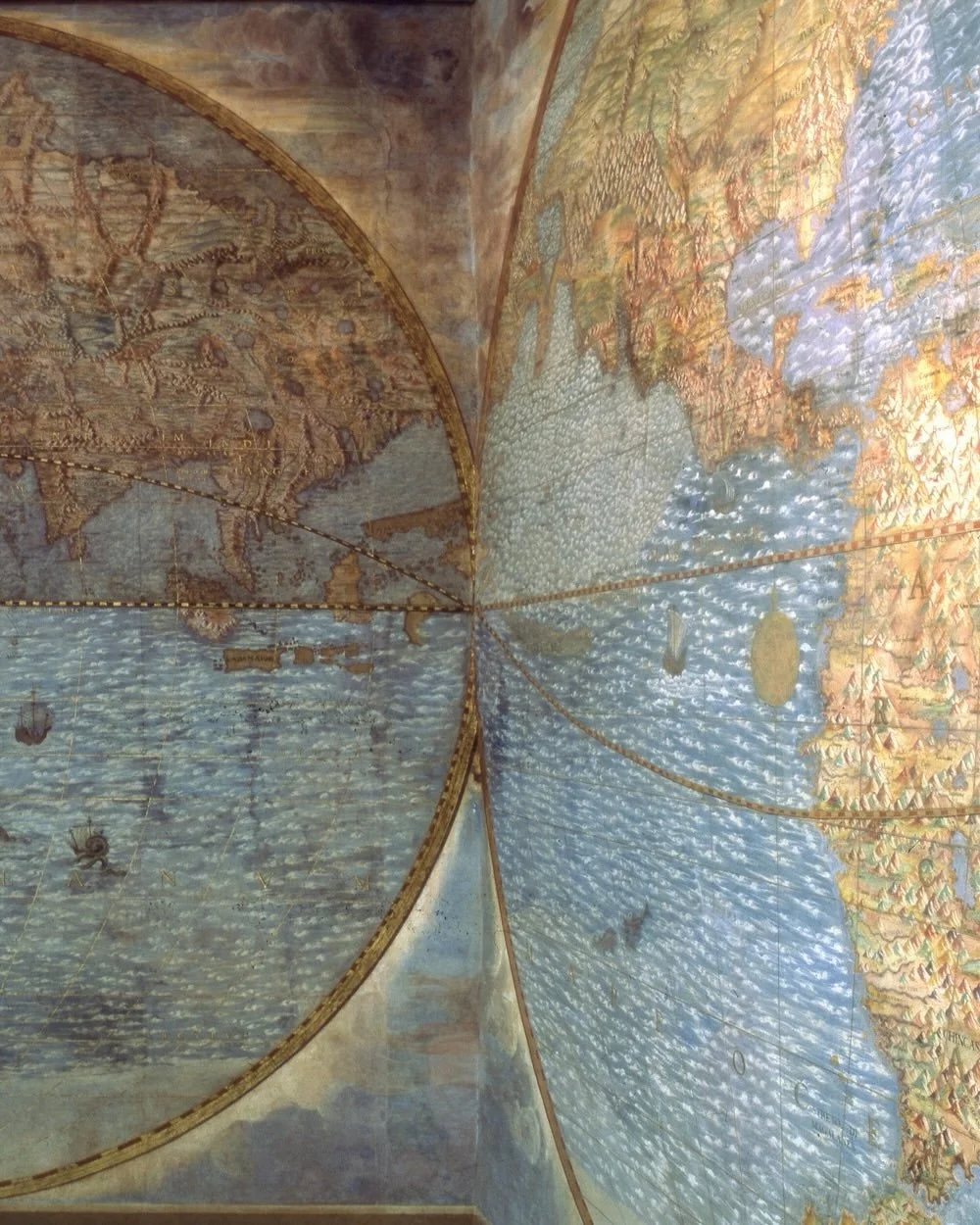
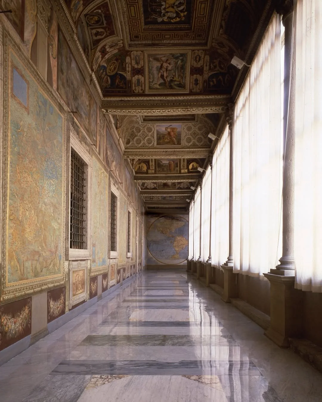
Commissioned by Pope Gregory XIII, the gallery stretches 120 metres through the Apostolic Palace. Its forty painted maps render the Italian territories and Church dominions at monumental scale, while its ceiling unfolds into a painted universe of sacred history, ornament, astronomy, and allegory.
For the McWhorter Family Trust, it offers a lasting model: knowledge is not merely accumulated. It is organized, preserved, and given form.
A Renaissance Vision of the World
Built in the late sixteenth century, the Gallery of the Geographical Maps brought together disciplines that are often separated today: architecture, geography, mathematics, astronomy, history, theology, and art.
The gallery was constructed by Ottaviano Nonni, known as Mascherino. Its frescoes were executed by a large team of artists coordinated by Girolamo Muziano and Cesare Nebbia, while the intellectual program was entrusted to the Dominican scholar Egnazio Danti a cosmographer, astronomer, and mathematician.
That collaboration is central to the room’s meaning. The maps are not simply decorative. They represent an institutional effort to make territory legible: to study regions, trace coastlines, understand cities, and situate local places within a wider order.
The Gallery of Maps: Geography as Architecture
The forty cartographic panels are arranged as a journey through the Italian peninsula. The Apennines serve as the organizing spine: regions facing the Ligurian and Tyrrhenian seas appear along one wall, while regions framed by the Alps and Adriatic appear along the other.
This is geography turned into architecture.
A visitor does not merely look at a map; they walk through a mapped world. The building creates sequence, scale, and perspective. It asks the viewer to understand that individual places cities, coasts, provinces, and ports are part of a larger system.
For institutions, families, and stewards, that idea remains relevant: a meaningful archive is not a pile of information. It is a framework that connects inheritance, place, people, and responsibility.
Science, Astronomy & the Measurement of Time
The Gallery of Maps belongs to the same intellectual world that made the Gregorian calendar possible.
Gregory XIII’s calendar reform was one of the defining scientific and administrative achievements of the era. It required precise attention to astronomical time, measurement, and the relationship between celestial cycles and civic life. Danti’s role as a mathematician, astronomer, and cosmographer makes the Gallery an expression of that same Renaissance confidence: that observation, calculation, and disciplined study could bring greater clarity to human affairs.
Above the maps, the ceiling expands the geographic vision into a cosmic one. The heavens, sacred narratives, and decorative programs remind the visitor that the Renaissance did not see science and meaning as opposing forces. Measurement and imagination were both tools for interpreting the world.
Art in Service of Memory
The visual richness of the gallery is inseparable from its purpose.
The frescoes, gilded architectural details, maps, inscriptions, and painted scenes make knowledge memorable. Art gives permanence to information that might otherwise remain abstract. A coastline becomes a work of craft. A city becomes part of a narrative. A corridor becomes an archive.
This is one of the enduring lessons of the Vatican’s Gallery of Maps: beauty can be a form of stewardship.
When culture is preserved with care, it becomes accessible across generations. It invites attention. It makes people pause long enough to learn.
The Institutional Lesson: Order Creates Legacy
The Gallery of Maps was made under papal patronage, but its broader lesson reaches beyond its original setting.
Every lasting institution must decide what it will preserve, what it will study, and how it will communicate its values. The strongest institutions do not only collect assets or records. They create order around them.
The McWhorter Family Trust approaches this idea through a continuing interest in:
cultural preservation and archival practice
architecture, estates, and the built environment
art, rare objects, and collecting
science, cartography, and exploration
commerce, stewardship, and long-term enterprise
history, family memory, and institutional continuity
The Gallery of Maps demonstrates how these fields can belong to one coherent vision. It is a reminder that legacy is not simply what survives. Legacy is what is deliberately arranged so that others can understand it.
A Living Archive
The Gallery of the Geographical Maps remains one of the most extraordinary examples of Renaissance cartography and interior design. Yet its significance is not confined to the past.
It asks a modern question: What does it mean to build an ordered world?
The answer may begin with maps, archives, art, and knowledge. But it continues through the choices institutions make every day what they protect, what they support, what they teach, and what they leave behind.
Knowledge should be preserved. Truth should be pursued. Progress should be guided by perspective, discipline, and purpose.